
It's one thing preparing well for exams and knowing your stuff but unless you interpret the question right and make the correct links in your responses you will fall short of the top marks available. Thanks to NIck who has grouped his own worksheet on exam command words with Daniel Raven Ellison's video clip. Both can be seen on Nick's Brauntan Geography Blog
Monday, April 30, 2007
Earthquake in England
 Believed to be 4.3 on the richter scale an earthquake hit Kent this weekend causing damage to houses and infrastructure. The epicentre of the quake was just a few kms from the the towns of Dover and Folkstone. Although earthquakes are not a frequent occurance in the UK they are reasonably active. Although most earthquakes occur at the boundaries of major crustal plates, they can occur, less frequently, within plates. The UK is on the British Eurasian plate.
Senior seismologist Dr David Booth, of the BGS, said there were lots of faults running through the British Isles. In this case, north-west pressure on the UK caused a build-up of energy in these fault systems, he said, and this energy was released - causing the earthquake.
Tuesday, April 24, 2007
Jigsaw France
Learn the Geogrpahy of France with this fun jigsaw of the regions of France Let me know through the comments how well you learned from it and what your fastest time was.
Tuesday, April 17, 2007
'green OPEC"
This is exactly how I see this site developing so thanks to Katt for sending through 'green OPEC' As she says in her comment it's ideal for the synoptic paper it shows how government decisions to move towards biofuels, whilst full of good intentions will have major impacts on the social and economic structures of societies in developing countries as well as enormous environment consequences.
There is alos an interesting article ob development and conservation concerning the paving of the B-163 in the Amazon.
There is alos an interesting article ob development and conservation concerning the paving of the B-163 in the Amazon.
Monday, April 16, 2007
The Miniature Earth
If the world's population was reduced to 100, it would look something like this.
Wednesday, April 11, 2007
Gapminder and Development indicators
Gapminder is an incredible site which along with a good number of publications is using Flash technology to create animations exploring development statistics. These animations are easy to use and help to develop a greater global awareness in comparing countries at different stages of development.
You can also watch this video on condions in slums
You can also watch this video on condions in slums
Tuesday, April 10, 2007
Oxfam Fair Trade Clips
Year 13 A level students might want to share this link with IB students for their development course. You should by now have a well formed position in regard to the trade/aid debate. This video is not endorsing Fair Trade as in the chocolate but rather fair trade, which along with apropriate aid is up there with effective governance in terms of important factors leading to development. Fair trade in this context refers to cutting government (agricultural) subsidies and opening up markets by reducing trading barriers such as, but not limited to financial tarriffs. It aslo highlights the problem of dumping cheap products on developing countries' markets. I'd be interested to hear some of your ideas. What do you think are the most important factors to develop countries.
An interesting book to read would be:
'How to spend $50 billion to make the world a better place' by Bjorn Lomborg. This book is available free on google.books
Monday, April 9, 2007
Managing Congestion
For cities to contunue to attract multinationals and industry they have to ensure ease of access. Goods and servics need to flow and this short clip helps to explain the problems of traffic congeston in New York as well as present some effective ways to manage congestion in other leading cities.
Aral Sea Returning

This is one of the case studies I've looked at for your 6.2, human impacts essay within the synoptic. There is also an interesting cross over to your 6.4 essay, communities and their governance.
Also look at the case study links to the right of the page
Sunday, April 8, 2007
Geographical skills
Not sure whether you guys are viewing this blog as it develops but I thought you might make good use of the following link for your applied geographical skills paper
Saturday, April 7, 2007
Evian - Waterboy
There's an amazing amount of Geography in this Evian ad'. How many aspects of the watercycle can you see? Where are the processes, storages and linkages?
Daft Punk saving the planet
Daft Punk have remixed the classic Pink Floyd's Proper Education and have given us all definite ways to reduce our energy use. Walking and riding your bikes to school isn't that bad.
MTV goes Geography
Kaiser Chiefs' recent single Ruby just shows that Geography is all around us. How many different examples of infrastructure can you see in their video? How important is infrastructure to the growth of cities? What functional zone of the city are the Kaiser Chiefs playing in? How do you know and would this be the best place for a free live performance?
Thursday, April 5, 2007
Micro Credit and development

When we think of development we often think of large projects, such as mines or dams that bring many benefits including jobs to LEDCs. However often the benefits are short lived or biased towards one region and create large debts that are difficult to repay. Whilst benefits may come to the country as a whole the local people may never see the benefits.
Alternatively NGO's work more closely with local people and bring benfits at a different scale. Intermediate and appropriate technologies are adopted and indigenous people are empowered to help themselves rather than be dependent on donor countries. One such strategy is micro credit peioneered by Mohammad Yusen and the Grameen Bank in Bangladesh they work to develop legitimate employment oportunities for the poorest of people.
You can slo read the Grameen Bank official website
Managing Cities - London Docklands
Extend your MEDC magaging cities knowledge with this account of London Docklands:
Londland Doklands to get its own Twin Towers
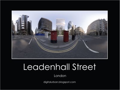
Check out the stunning panaramic of Leadenhall Street in the Docklands
Tomb with a View

As part of your work on Managing settlements we've used Cairo as our case study for LEDC cities. You need to develop your specific knowledge of Cairo. Cities evolve all the time and with it the management strategies of the government. Read This BBC article on new attempts to manage squater settlements in Cairo in more sustainable ways.
Bitesize Revision Podcasts
A range of Geography revison “audiobite” podcasts can be found at Bitesize Podcasts
Also try these websites for extra revision, quizes and testing your knowledge:
S-Cool
Bitesize Geography
internetgeographer
Check out the other Blog sites in the links section
Also try these websites for extra revision, quizes and testing your knowledge:
S-Cool
Bitesize Geography
internetgeographer
Check out the other Blog sites in the links section
Wednesday, April 4, 2007
Noel Jenkin's advise on Level marking at GCSE
In the GCSE exam, answers worth more than 4 marks will be marked using a level of response. You are not awarded a mark for every correct point you make. In general it works like this:
Level 1: Basic (1 or 2 marks)
Knowledge of basic information
Simple understanding
No links between statements
Little or no detail
Few specialist terms
Level 2: Clear (3 or 4 marks)
Knowledge of accurate information
Clear understanding
Links between statements
Some named examples
Use of specialist terms
Level 3 (5 or 6 marks)
Usually found at the end of a question, a level 3 answer requires in depth knowledge and understanding, very clear links between statements, and detailed case study examples.
Here is an actual example of levelled marking from the Year 10 end of topic test that I’ve just marked.
Question: Describe the main features of the outer suburbs of a settlement (4 marks) (AQA A 2005 Higher)
Student A wrote:
There are lots of green space, modern housing, curved roads and very quiet.
This answer gets L1 basic. (2 marks) Simple knowledge is shown, but there are no links between statements.
Student B wrote:
Outer suburbs generally house upper class residents. Houses are more likely to be detached and there would be more fields. The motorway or large road heading to the CBD would be present. Also there may be airports or big shopping malls that are easy to get to.
This answer gets L2 clear (4 marks) as the student makes two linked statements .
The final question on the paper was:
Describe how governments of MEDCs try to cope with urban sprawl. (6 marks)
Read the following answer and then submit a comment suggesting the level at which you would mark the answer, and why. Re-read the criteria for level marking first!
Student C wrote:
In MEDCs, in particular Britain, the government has created green belts to stop cities from continuing to grow too far into the countryside. Instead the growing population can be housed in new towns containing spacious housing and many services. Also in older cities, inner city areas can be re-furbished or rebuilt, creating more space for new homewosks, businesses and services, though it is often more expensive.
Mass Movement
The relationship between the different components of the physical environment is complex and often finely balanced. Watch the clip and think about the different human and physical factors that may have led to such a dramatic event. Feel free to post your thoughts through the comments section
Subscribe to:
Posts (Atom)
